AGIS for Windows 2002
AGIS for Windows is a mapping and simple GIS shareware package.
AGIS for Windows is a mapping and simple GIS shareware package. Plot your own geographic data on the map of the world provided without the high cost and steep learning curve usually associated with this kind of software.
Software Specs
Publisher:............ AGIS Software Pty Ltd
License:............... Shareware
Price:................... $49
Expire: ................ 30
File size:.............. 3.57 MB
Downloads:.........
Release date:...... 30 May 2003
Last update:........ 28 Nov 2013
Language:............ English
Publisher review for AGIS for Windows 2002:
Review by: AGIS Software Pty Ltd
AGIS for Windows is a mapping and simple GIS shareware package. Plot your own geographic data on the map of the world provided without the high cost and steep learning curve usually associated with this kind of software. Create high resolution publication quality images that can be pasted into popular packages such as MS Word. Animation, web serving, distance measuring, searching, GPS and integration with other systems such as databases are also supported. Import MapInfo .mif/.mid, ARCInfo text .e00 and arc generate, South African national exchange standard and Garmin GPS track files. Tutorials and additional support are available from the web site.
Requirements:
256 color display
Operating system:
Win95,Win98,WinME,WinNT 3.x,WinNT 4.x,WinXP,Windows2000
Release notes:
Major Update

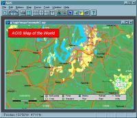
AGIS for Windows screenshots:
AGIS for Windows download tags:
GIS map mapping shareware freeware GPS server animation world
Copyright information:
SPONSORED LINKS
Based on 1 ratings. 1 user reviews.