AirPhotoSE 2.39.156
Edit, combine and process geographical image maps
Edit, combine and process geographical image maps
ADVERTISING
Software Specs
Publisher:............ Irwin Scollar
License:............... Freeware
File size:.............. 52.4 MB
Downloads:.........
Release date:...... 04 Mar 2013
Last update:........ 12 Aug 2014
Publisher review for AirPhotoSE 2.39.156:
Review by: Irwin Scollar
AirPhotoSE is designed to help you edit geographical image maps. It can work with very large image files, while also processing up to four parts of the picture at the same time.
Designed with ease of use in mind, AirPhotoSE can help you combine aerial images with maps or satellite pictures. It supports Google Earth images and orthophotos.
Requirements:
Operating system:
Windows 8, Windows 7, Windows Vista, Windows XP, Windows 2000, Windows 98

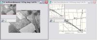
AirPhotoSE screenshots:
AirPhotoSE download tags:
picture editor process image map editor calibration
Copyright information:
SPONSORED LINKS
Rate this software
AirPhotoSE
Based on 0 ratings. 0 user reviews.
Based on 0 ratings. 0 user reviews.