Eye4Software Hydromagic 7.1.32.60822
A hydrographic survey software tool, which can be used to map areas using a GPS and echoso
A hydrographic survey software tool, which can be used to map areas using a GPS and echosounder
Software Specs
Publisher:............ Eye4Software BV
License:............... Trial
Price:................... $999.00
File size:.............. 86528 MB
Downloads:.........
Release date:...... 08 Jul 2013
Last update:........ 31 Aug 2016
Publisher review for Eye4Software Hydromagic 7.1.32.60822:
Review by: Eye4Software BV
Hydrographic Survey Software for Windows, Generare depth maps using a GPS or RTK receiver and an echosounder or fishfinder. Generate DTM's (Digital Terrain Models), generate depth contours, generate cross-sections, generate depth maps, calculate tides using RTK, calculate volumus and more. The software can be used with various map formats including: GeoTIFF, Microstation DGN, ARC/INFO, MapInfo MIF/MID, AutoCad DXF files, IHO S57/S63 Electronic Natutical Charts and ESRI shapefiles. The software has more then 5000 built-in local map projections.
Requirements:
Operating system:
Windows XP / Vista / Vista 64 bit / 7 / 7 64 bit / 8 / 8 64 bit

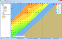
Eye4Software Hydromagic screenshots:
Eye4Software Hydromagic download tags:
hydrographic survey area mapper GPS map GPS
Copyright information:
SPONSORED LINKS
Based on 0 ratings. 0 user reviews.
WSUS Offline Update
Popup Workshop - The Best Web Hover Ad Generator
3S Accounting
Cash Counter
IOREG
AMC Reporter
Speed Bid for eBay
Chilkat FTP C++ Library
Banker
MIETrak
Accounting and Finance
Office Suites and Tools
Inventory and Barcoding
PIMS and Calendars
Databases and Tools
Project Management
Helpdesk and Remote PC
Calculators and Converters
Vertical Market Apps
Investment Tools
Math and Scientific Tools
Other
Timesheets MTS Software
Softvoile
NewFreeDownloads
Office Suites
PIMS
Math
Calculators
Helpdesk
Databases
Accounting
Inventory