Geodata Germany 15.02
Geodata of Germany with towns, postal codes, preselections, landscapes ec.
The database contain geodata of the Federal Republic of Germany with geo referenced towns, municipalities, town quarters, administrative units, postal codes, telephone preselections, nature areas, landscapes, climatic zones for proximity searches ec.
Software Specs
Publisher:............ C. Killet Software Ing.-GbR
License:............... Data only
Price:................... $200.00
Expire: ................ 9999
File size:.............. 1.93 MB
Downloads:......... 681
Release date:...... 04 Apr 2011
Last update:........ 18 Jul 2011
Language:............ German, English
Publisher review for Geodata Germany 15.02:
Review by: C. Killet Software Ing.-GbR
The database tables contains geodata of the Federal Republic of Germany with geo referenced towns, municipalities, town quarters and other administrative units, postal codes, telephone preselections, nature areas, landscapes, climatic zones and official topographical cartographies. The data contain coordinates for navigation and geo-coding, proximity searches and distance computations and are prepered for the spatial mapping of environmental information. Quite often it is necessary to reference an address field e.g. like town or municipality name, postal code or telephone preselection, to corresponding geographical data and coordinates - a Geo Reference. The geo reference can be used for example to direct a customer to the closest store locations of a retail store chain by doing a proximity search. Another possibility it to determine distances between the different objects of the database tables with the included geo references. With the elevation data from a Digital Elevation Model the ground level height of each place can be determined. Often the knowledge is necessary about affiliations and relationships between data derived from different hierarchies. So it can be determined to which federal state, governmental area or governmental county a town, a postal code or a telephone preselection is associated. It is possible to assign a variety of natural and scenic information to each town or municipality. The snow and wind load zones are available as local climatic data. In conjunction with the ground level heights they can be used to calculate static loads for the planning of building constuctions.
11.500 Towns and Municipalities with geo references.
108.000 Town Quarters with geo references.
32.000 Postal Codes with geo references.
20.500 Telephone Preselections with geo references.
450 Administrative Countys.
Administrative Districts.
Federal States of Germany.
Landscapes.
Nature Area Classification.
Snow and Wind Load Zones.
Cartograpies.
Requirements:
All systems
Operating system:
Not Applicable
Release notes:
Major Update
Whats new in version 15.02:
Update of all data base tables with actuality date January 1st. 2011. Added data tables with information of the Official Topographic Maps. Implemented territorial changes in Saxony-Anhalt. New database tables with the Snow and Wind Load Zones and with Nature Area Classification and Landscapes.

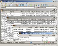
Geodata Germany screenshots:
Geodata Germany download tags:
geo data geodata coordinate coordinates periphery proximity search nature area classification landscape snow wind load zone elevation sea level sealevel computation distance calculation branch reference correlation coding longit
Copyright information:
Based on 1 ratings. 1 user reviews.
DBDesigner 4
DB-MAIN
SQL-Front
Full Convert Enterprise
PC-Telephone
Liquid Desktop
Advanced Access Repair
ERD Concepts
Oraspeed SQL Editor
Accounting and Finance
Office Suites and Tools
Inventory and Barcoding
PIMS and Calendars
Databases and Tools
Project Management
Helpdesk and Remote PC
Calculators and Converters
Vertical Market Apps
Investment Tools
Math and Scientific Tools
Other
Timesheets MTS Software
Softvoile
NewFreeDownloads
Office Suites
PIMS
Math
Calculators
Helpdesk
Databases
Accounting
Inventory