OkMap 13.7.3
OkMap - GPS Mapping Software for many outdoor activities
OkMap is a free software for many outdoor activities: Trekking, Off road, Mountain bike, Sailing, Hunting and fishing, Finding mushrooms, Soft air, Geocaching, And many others...
Software Specs
Publisher:............ Gian Paolo Saliola
License:............... Freeware
Price:................... 0.00
File size:.............. 40243.2 MB
Downloads:.........
Release date:...... 13 Jan 2010
Last update:........ 11 May 2017
Publisher review for OkMap 13.7.3:
Review by: Gian Paolo Saliola
OkMap is a free software for many outdoor activities:
- Search and rescue
- Trekking
- Off road
- Boating
- Flying
- Mountain bike
- Geocaching
- Hunting and fishing
- Finding mushrooms
- Soft air
OkMap help you to:
- Calibrate raster maps with different types of projections
- Create own digital maps drawing points, multipoints, polylines and polygons
- Display simultaneously raster and vectorial maps
- Import vectorial data with different types of cartographic projections
- Use raster and vectorial maps as background for navigation
- Create and manage waypoints, routes and tracks in GPX format
- Automatic determination of road paths (autorouting)
- Determination of coordinates from street addresses (geocoding) and viceversa
- Use digital terrain models to display the elevation
- Upload and download data to and from a GPS device (Garmin and Magellan)
- Navigate in real time with a GPS device through NMEA protocol
- Display Google Earth and Google Maps in current map location
- Exchange data with Google Earth and view your map in 3D
- Find nearby cache in geocaching.com web site
- Exchange data with gpsgate.com server
- Receive customized navigation data from remote GPS devices
- Send the current position to an OkMap remote server
- Make conversions between different types of coordinates, datums, formats, etc..
- Use a handy calculator for your calculations
Supported languages:
- English
- Italian
Supported formats:
- Images: ecw, bmp, gif, jpg, png, tif and many others
- Maps: gfw, jgw, pgw, tfw, bpw (Drg maps); ecw (Earth Resource Mapping); map (OziExplorer); gmi (GpsTuner)
- Vector data: shp, dbf (Esri shape file); dcw (Digital Chart of World)
- GPS data: gpx (GPS Exchange Format); kml (Keyhole Markup Language); wpt, plt, rte (OziExplorer); loc (Geocaching) and many others formats thanks to the software GpsBabel
- DEM data (digital earth model): hgt (SRTM-1 and SRTM-3)
Requirements:
Microsoft .NET Framework 3.5 SP 1
Internet Explorer 5 or above
Processor: 400 Mhz (recommended 1 GHz)
HDD: at least 35 MB
RAM: 128 MB or higher (recommended 512 MB)
ECW ac
Operating system:
Windows XP / Vista / Vista 64 bit / 7 / 7 64 bit / 8 / 8 64 bit / 2003 / 10 / 10 64 bit

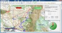
OkMap screenshots:
OkMap download tags:
okmap gps software free map gpx cartography raster digital vectorial autorouting geocoding calibrate garmin magellan gpsbabel freeimage ecw shp hgt dem srtm projection poi waypoint route track nmea conversion datum
Copyright information:
Based on 0 ratings. 0 user reviews.
WSUS Offline Update
Popup Workshop - The Best Web Hover Ad Generator
3S Accounting
Cash Counter
IOREG
AMC Reporter
Speed Bid for eBay
Chilkat FTP C++ Library
Banker
MIETrak
Accounting and Finance
Office Suites and Tools
Inventory and Barcoding
PIMS and Calendars
Databases and Tools
Project Management
Helpdesk and Remote PC
Calculators and Converters
Vertical Market Apps
Investment Tools
Math and Scientific Tools
Other
Timesheets MTS Software
Softvoile
NewFreeDownloads
Office Suites
PIMS
Math
Calculators
Helpdesk
Databases
Accounting
Inventory