PixGPS 1.1.6
Use a GPS to track your photos
Use a GPS to track your photos
Software Specs
Publisher:............ BR Software
License:............... Trial
Price:................... $ 19.95
File size:.............. 3.36 MB
Downloads:.........
Release date:...... 04 Oct 2008
Last update:........ 29 Apr 2014
Publisher review for PixGPS 1.1.6:
Review by: BR Software
PixGPS is a simple program for Microsoft Windows that makes it simple to insert the exact position of each photo (latitude and longitude) into the photos EXIF meta data.
All you need is a digital camera that stores EXIF inside the image file (most cameras do this) and a GPS Receiver that can store track logs in GPX format.
PixGPS makes it easy to geotag your digital photos. Just download the photos from your camera and get the GPX formatted track log from your GPS Receiver. The PixGPS Geotagger will in matter of seconds calculate the latitude and longitude for each of the photos. It will store the latitude and longitude in each photos EXIF meta data so it will stay with the photo.
Operating system:
Windows 2K / XP / Vista / 7

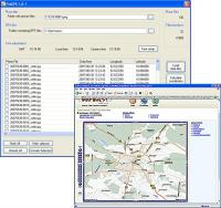
PixGPS screenshots:
PixGPS download tags:
art digital exif gps hot jpeg jpg map photo tag track
Copyright information:
SPONSORED LINKS
Based on 0 ratings. 0 user reviews.