TNTmips 2017.20170712
Geospatial software solution
Geospatial software solution
Software Specs
Publisher:............ MicroImages, Inc.
License:............... Freeware
Price:................... 0.00
File size:.............. 190771.2 MB
Downloads:.........
Release date:...... 04 Nov 2014
Last update:........ 14 Jul 2017
Publisher review for TNTmips 2017.20170712:
Review by: MicroImages, Inc.
TNTmips is a comprehensive Geographic Information System (GIS) developed to help you work with virtually any type of geospatial data including imagery, terrain surfaces, and map data with associated database attributes.
It provides many tools you need to view, create, edit, georeference, interpret, and publish any type of geospatial data.
Requirements:
Operating system:
Windows XP / XP 64 bit / Vista / Vista 64 bit / 7 / 7 64 bit / 8 / 8 64 bit / 10 / 10 64 bit

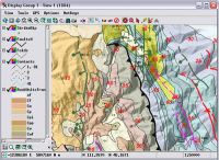
TNTmips screenshots:
TNTmips download tags:
Copyright information:
SPONSORED LINKS
Based on 0 ratings. 0 user reviews.
WSUS Offline Update
Popup Workshop - The Best Web Hover Ad Generator
3S Accounting
Cash Counter
IOREG
AMC Reporter
Speed Bid for eBay
Chilkat FTP C++ Library
Banker
MIETrak
Accounting and Finance
Office Suites and Tools
Inventory and Barcoding
PIMS and Calendars
Databases and Tools
Project Management
Helpdesk and Remote PC
Calculators and Converters
Vertical Market Apps
Investment Tools
Math and Scientific Tools
Other
Timesheets MTS Software
Softvoile
NewFreeDownloads
Office Suites
PIMS
Math
Calculators
Helpdesk
Databases
Accounting
Inventory